The Tian Shan Mountains act as a natural boundary between the Oasis Road and the Steppe portion of the Road. A large system of mountain ranges, the Tian Shan mountains divides Asia into northern and southern portions. This extends for about two thousand km from China's Xinjiang region in the east to the Pamir Mountain Range in the west. The Tian Shan mountains range to about 5,000 meters above sea level, with its highest "Victory" Peak being 7,439 meters above sea level. Grasslands border the range to the north, while the Tarim and Turpan Basins border the south. To the northeast there lies a basin known as the Dzungarian Basin. The Tian Shan Mountains had considerable influence on history and way of life for many peoples living in and around the Silk Road. The grasslands bordering the north were formed due to the natural barrier the Tian Shan Mountains make against humid air currents. This allowed people dwelling in this region to pursue a more nomadic way of life. Xiongnu and Turks both originate from this region. The Range also acts as a barrier against damp air wishing to push south. This has resulted in desert or basin environments. Ice melting from the mountain tops also allowed the formation of oases. This also enabled irrigated agriculture. Some oases cities include Turpan (Turfan) Aksu, and Kucha. The south is characterized by its orbit of these oases, while the north is characterized by its more temperate, nomadic grasslands. More ancient mountain passes once allowed for connections between the Oasis Road in the south with the northern Steppe portion of the Road. The Tian Shan Mountains appear to be both a blessing and a curse for the traders and travelers of the Silk Road, offering protection and fertility to the Steppe of the north, while blocking off the southern portion of the range, forcing it into a considerably arid environmental state.[1]
Hansen uses the Tian Shan Mountains to detail characteristics that it presented not just to the region but also to the travel that was typical along and at one time through the Tian Shan Mountain Range. The Tian Shan are a part of the Pamir Knot, which consists of the Himalayas, Tian Shan, Karakoram, Kunlun, and Hindu Kush. Hansen also noted French Scholar Paul Pelliot who came to Kucha in 1907. During his travels in the region, Pelliot explored the routes through the Tian Shan Mountains for an entire month. The Tian Shan Mountains lie on the most traveled route west along the Silk Road. Mount Ling is one of the biggest summits lying in the Tian Shan Mountain range. The Tianshan Mountains are known to be relatively dry, with most of the snow lying at the top of the mountain. The Ammoniac Mountains, a part of the Tianshan Mountains, were a major source of the chemical ammonium chloride, an important trade good on the Silk Road.[2]
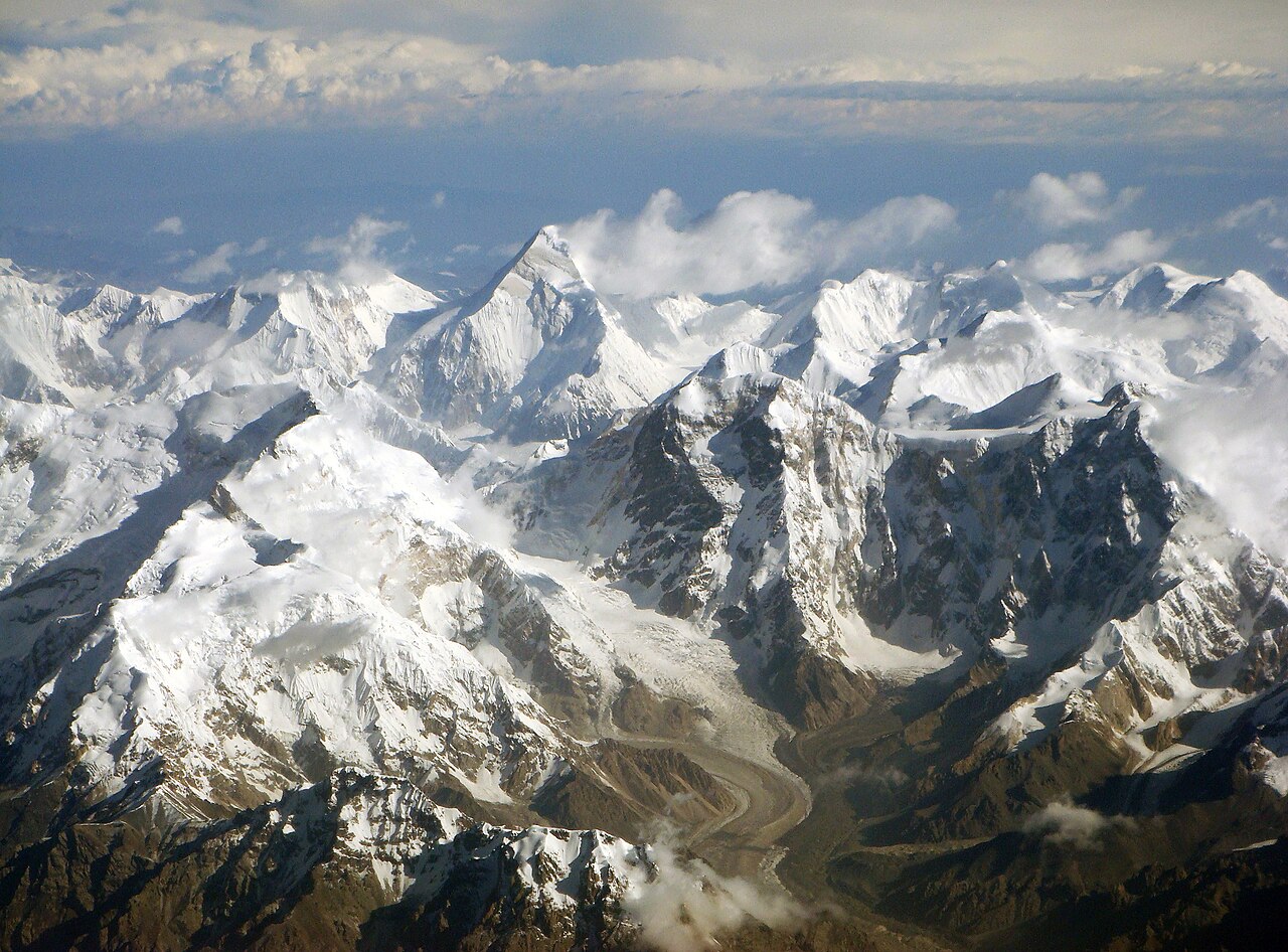
Tian Shan Mountains, from Clouds[3]
[1] Čōñ, S.-I. (2016). The Silk Road Encyclopedia. Seoul Selection
[2] Hansen, Valerie. The Silk Road: A New History with Documents (Oxford, 2016).
[3] https://upload.wikimedia.org/wikipedia/commons/thumb/b/b1/Central_Tian_Shan_mountains.jpg/1280px-Central_Tian_Shan_mountains.jpg